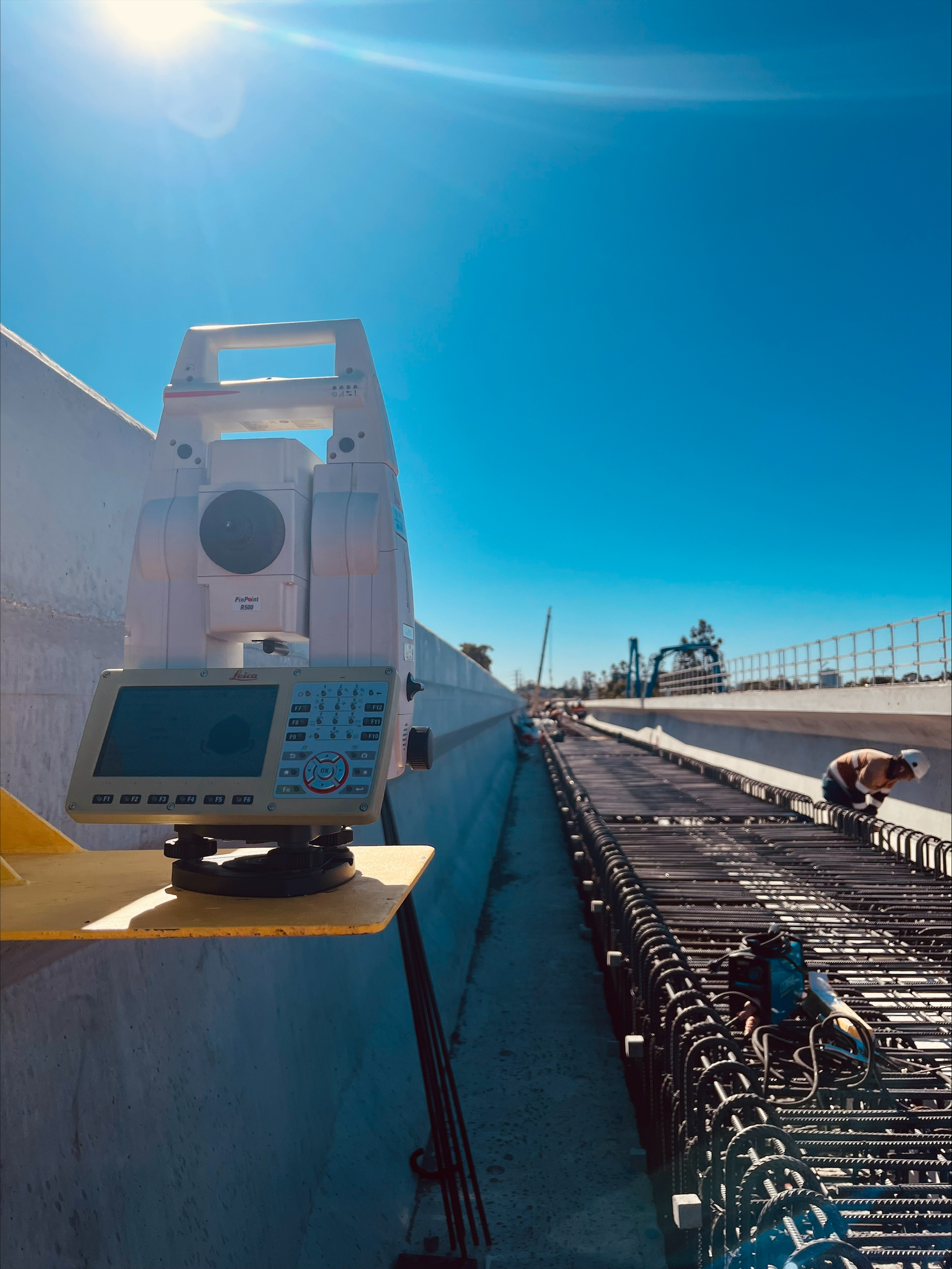
Melbourne's leading drone surveying service with CASA-certified UAV operations and professional surveyors. We deliver aerial LiDAR, photogrammetry, and topographic surveys integrated with traditional surveying for construction monitoring, infrastructure projects, and development across metropolitan Melbourne and Victoria.
Experience the difference of working with Australia's leading surveying professionals. Precision Delivered since 2012.
Pioneering drone surveying in Australia with advanced LiDAR and photogrammetry capabilities for rapid, accurate data collection across any terrain.
Access challenging or dangerous sites safely with our certified drone pilots and advanced UAV fleet, delivering data where traditional methods can't reach.
State-of-the-art drone LiDAR, high-resolution cameras, and real-time processing delivering detailed topographic maps, 3D models, and volumetric analysis.
HR Surveyors provides professional drone surveying services across Melbourne and Victoria from our Huntingdale headquarters. Our team combines CASA-certified UAV operations with professional surveyors to deliver survey-grade accuracy for construction monitoring, infrastructure projects, and development works throughout metropolitan Melbourne and regional Victoria.
Address
12 Distribution Circuit, Huntingdale, VIC 3166
Service Areas
Melbourne Metro, Eastern Victoria, Geelong region
Regular progress monitoring and volumetric calculations for Melbourne construction sites including high-rise developments in CBD, Southbank, Docklands, and suburban projects. Our drone surveys integrate with traditional set-out and as-built surveys for comprehensive project documentation.
Aerial surveying for Melbourne infrastructure projects including road upgrades (West Gate Tunnel, M80), rail projects (Metro Tunnel), and level crossing removals. Our professional surveyors ensure data meets VicRoads and project authority requirements.
Rapid topographic data collection for development sites across Melbourne. From inner-city redevelopment to greenfield sites in growth corridors, our UAV services deliver accurate terrain data for design and planning.
Survey-grade accuracy with RTK correction and ground control
Professional UAV platforms, LiDAR sensors, high-resolution cameras
CASA ReOC 5661, Professional Surveyors Victoria, Victorian Building Authority compliance
Explore our portfolio of successful projects demonstrating our expertise and precision delivery across diverse challenges.


Includes Beckenham, Carlisle, Queens Park, Cannington, and Oats Street Stations


Ready to see your project delivered with the same precision and expertise?
Start Your ProjectDiscover complementary surveying services often combined with this solution for comprehensive project delivery.
National drone surveying services with Melbourne-based team serving Victoria and regional projects.
LiDAR surveying services available across Melbourne and Victoria for vegetation penetration and terrain analysis.
Melbourne construction monitoring services for high-rise developments and infrastructure projects.
Many clients choose to combine multiple surveying services for comprehensive project coverage and enhanced value delivery.
Get professional drone surveys for your Melbourne project. Our Huntingdale-based team combines CASA-certified UAV operations with licensed surveying expertise.
Get Melbourne Drone Survey Quote