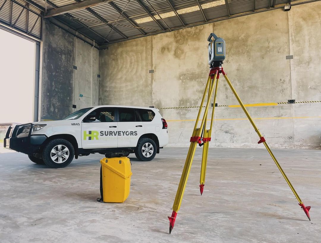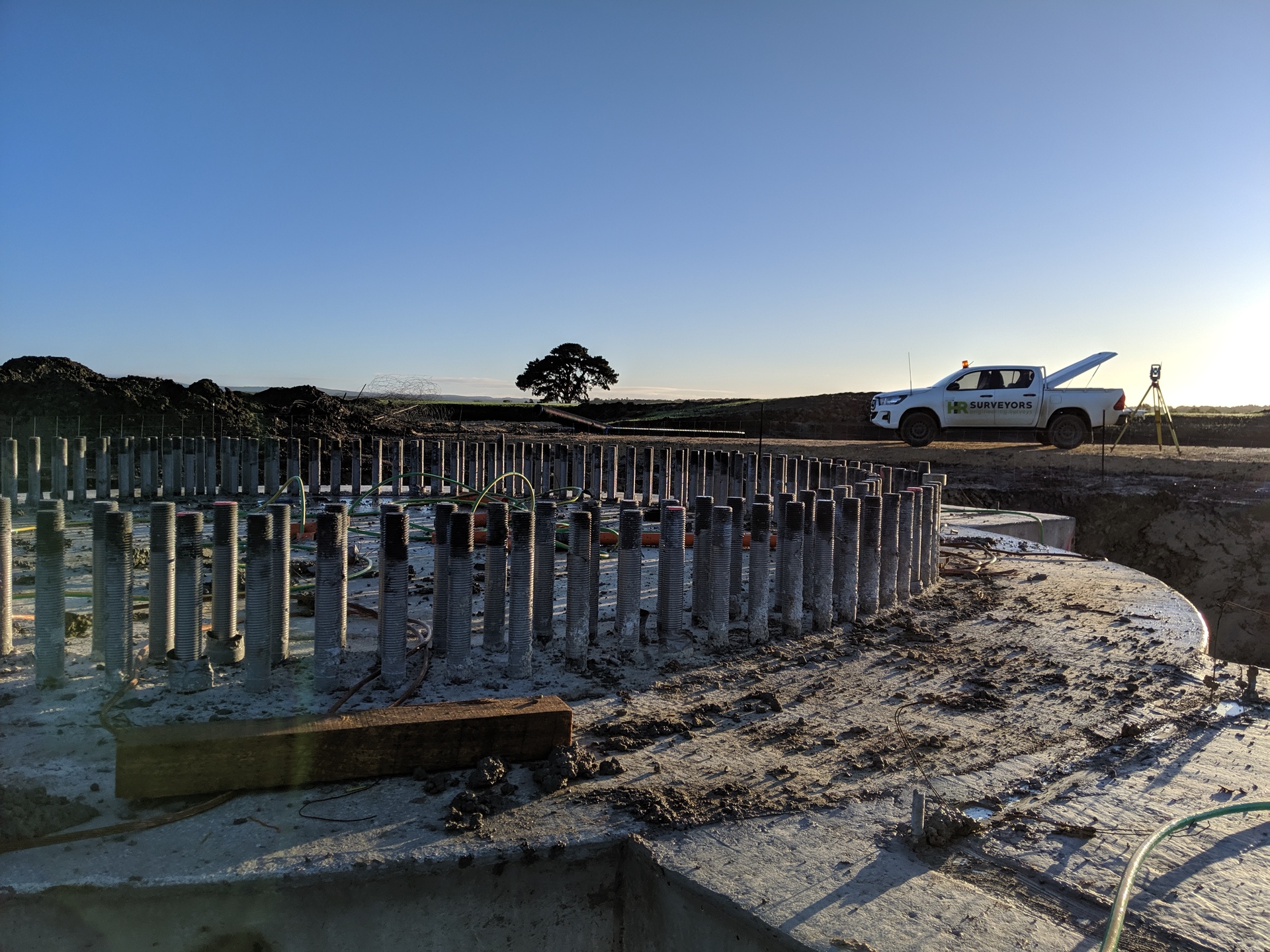
Specialist surveying for Australia's renewable energy sector. Our experienced teams support wind farm, solar farm, and battery energy storage projects from initial land assessment and site feasibility through construction set-out, drone surveys, monitoring, and final as-built documentation — with offices in VIC, WA, QLD, and SA positioned near key renewable development zones.
Experience the difference of working with Australia's leading surveying professionals. Precision Delivered since 2012.
Since 2012, we've delivered precision engineering surveys for Australia's most complex infrastructure projects, from high-rise developments to major civil works.
With 5 strategic office locations and 70+ qualified professionals, we provide comprehensive engineering surveying services across all major Australian markets.
Advanced 3D scanning, UAV LiDAR, and real-time GPS systems ensure millimetre accuracy for your engineering projects, reducing risks and delays.
HR Surveyors has supported renewable energy development across Victoria, Western Australia, Queensland, and South Australia for over a decade. Our teams understand the specific surveying requirements of wind, solar, and battery storage projects — from large-scale land assessment and topographic surveys for feasibility and environmental impact assessment through to precision foundation set-out, construction monitoring, drone-based asset inspection, and final as-constructed documentation for handover and asset management. In Victoria, our Huntingdale and Geelong offices are positioned close to the state's active wind and solar development zones — see our renewable energy guide for how surveys support each project stage in Victoria.
Land assessment, control network establishment, turbine foundation set-out and as-poured pick-ups, access road and hardstand surveys, underground cable route surveys, structural monitoring, and as-built documentation for wind energy projects. We work with developers, EPC contractors, and owner operators across the full project lifecycle.
Feature and level surveys for site design, piling and tracker foundation set-out, inverter station positioning, substation layout, and final as-constructed surveys for utility-scale solar projects. Precise layout is critical across thousands of tracker piles — misalignment compounds quickly at scale.
Land assessment and precision layout surveys for battery energy storage systems (BESS), grid connection infrastructure, and substation foundation set-out. We provide the accurate control networks and foundation positioning that electrical and structural engineers require.
Large-area topographic surveys combining UAV LiDAR and ground survey for renewable energy site selection, wind resource analysis, solar irradiance modelling, and environmental impact assessment. We cover tens to hundreds of hectares efficiently with survey-grade accuracy, including access route and grid connection corridor assessments.
CASA-certified drone operations for wind farm blade and tower inspections, turbine terrain modelling, micro-siting data, and construction progress monitoring. High-resolution imagery and LiDAR tied to survey control give asset owners and EPCs measurable, repeatable condition data — identifying blade defects, erosion and wear without rope access or crane shutdowns.
Deformation and settlement monitoring on foundations, pads, and structural elements during construction, plus pickup surveys and final as-constructed documentation. Monitoring data supports engineering sign-off, warranty obligations, and asset management handover.
Construction-grade set-out accuracy for foundations; topographic data to ±50 mm or better for feasibility
RTK GNSS, Leica total stations, UAV LiDAR and photogrammetry, drone inspection platforms
National Construction Code compliance; CASA ReOC certified drone operations; state-specific renewable energy planning requirements
Wind farm surveying typically includes: large-area topographic surveys and land assessment for site feasibility and EIA; control network establishment across the project area; turbine foundation set-out and as-poured pick-ups; access road and hardstand surveys; underground cable route surveys; substation layout surveys; drone blade and turbine inspections; and final as-constructed documentation for handover and asset management. We work with developers, EPCs, and owner operators at each stage.
Yes. Our teams have supported numerous utility-scale solar projects across Victoria, Queensland, South Australia, and Western Australia, including piling set-out, tracker foundation layout, inverter station positioning, and as-built surveys. For large solar farms with thousands of tracker piles, precise layout and quality checking at each stage is essential — small errors accumulate and become expensive to correct later.
Wind farm drone surveys cover two distinct needs: blade and tower inspection, where high-resolution cameras and LiDAR capture surface defects, erosion, lightning damage and wear on turbine components without rope access or crane shutdowns; and terrain surveying, where drone LiDAR and photogrammetry produce turbine pad, access road and micro-siting terrain models. All drone data is tied to survey control so it can be measured, compared over time and integrated into asset management systems. Our drone operations are CASA ReOC certified.
We operate across Victoria, Western Australia, Queensland, and South Australia — four states with Australia's most active renewable energy pipelines. Our offices in Huntingdale (VIC), Geelong (VIC), West Leederville (WA), Loganholme (QLD), and Edinburgh North (SA) are each positioned near key renewable development zones, reducing mobilisation costs and enabling rapid response to project demands.
Yes. We provide deformation and settlement monitoring on turbine foundations, solar tracker systems, substation structures, and battery storage facilities during construction. Repeatable monitoring programs track movement over time and produce the records engineers and asset owners need for assessment, compliance and sign-off — and they feed directly into our final as-built documentation.
Explore our portfolio of successful projects demonstrating our expertise and precision delivery across diverse challenges.


Includes Beckenham, Carlisle, Queens Park, Cannington, and Oats Street Stations
Ready to see your project delivered with the same precision and expertise?
Start Your ProjectDiscover complementary surveying services often combined with this solution for comprehensive project delivery.
Engineering survey support for South Australia's resources, renewables and Spencer Gulf infrastructure, including drone volumetrics and conformance.
Drone-based condition inspection for wind and solar assets, transmission infrastructure and battery storage sites, tied to survey control.
Full-service drone surveying with LiDAR and photogrammetry for renewable energy developers across Australia.
Many clients choose to combine multiple surveying services for comprehensive project coverage and enhanced value delivery.
Join thousands of satisfied clients who trust HR Surveyors for their most important projects. Get your free consultation today and discover why we're Australia's leading surveying professionals.